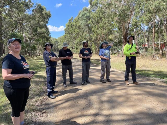
The Moorabool Catchment Landcare Group (MCLG) was joined by members of the community, Wadawurrung Traditional Owners and CSIRO scientists last week for its koala monitoring project.
Conducted as part of the federal government’s National Koala Management Plan, the scientific outing sought to leverage the specific skills of these three groups of people to assist in creating a comprehensive picture of the species in the area.
Arriving from Brisbane and Townsville, researchers from the CSIRO performed a thermal drone survey of the 25-hectare plot in Gordon.
This technology flies above the bushland area, taking infrared snapshots every 10 seconds. The flying device allows scientists to cover immense distances.
Those in attendance at the data seeking mission also participated in a walking transect survey, where member of the Wadawurrung First Nations group provided insights on the values of planned indigenous burnings for reestablishing koala habitats.
MCLG landcare co-ordinator Jackson Cass said although there were no sightings made, it was a still a worthwhile exercise.
“The thing about this sort of early data-seeking effort is that it’s just as important to not find them as it is important to find them,” Mr Cass said.
“When there’s no baseline data, you have nothing to compare to, so it’s really important to establish that, so down the track it becomes very valuable information for you to have.”
Mr Cass said he was also very encouraged by the amount of community interest in understanding koala numbers in the shire.
MCLG has been encouraging those in the area to record sighting of koalas in the iNaturalist app.
In the month of February, 18 observations were logged in the Moorabool area, compared with a total of 12 observations for the entirety of 2021.
“There’s been a lot of capacity built within the community,” Mr Cass said.
“I would be confident in saying that this is definitely something we will look at trying to achieve on a larger scale.”

