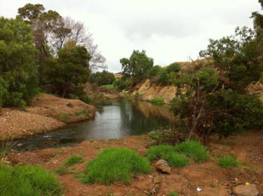
Floodprone land in Moorabool is one step closer to being protected from overdevelopment after a planning panel recommended new overlays be added to the local planning scheme.
Planning panel chair Chris Harty and member Michael Wheelahan have released a report recommending the state government sign off on the amendment, which proposes new development permit triggers in land identified as subject to inundation within the catchments of the Werribee River, Lerderderg River and Little River.
The amendment includes land in Blackwood, Ballan, Greendale, Darley, Bacchus Marsh, Maddingley and Balliang identified in various flood mapping studies.
Changes would introduce the Land Subject to Inundation Overlay (LSIO) and the Special Building Overlay (SBO) to the Moorabool Planning Scheme, meaning the impact of flooding would have to be considered as part of any future development in the identified flood-prone areas.
The proposal attracted 41 submissions when advertised last year, 35 of which opposed the changes.
Key issues raised in submissions included whether the amendment was necessary, the appropriateness of the proposed planning controls and the accuracy of the flood extent mapping.
Other concerns raised in submissions included flood mitigation including drain maintenance and the potential effects on property values and insurance.
However the planning panel found the amendment is “overwhelmingly supported” under relevant planning laws and policies and has “sound strategic justification” given the nature of the flood risks identified in the flood studies.
“An important feature of the application of the LSIO and SBO is that they do not prohibit development,” the report stated.
“The overlays will provide for the identification of land subject to flood risk within the eastern portion of Moorabool Shire and establish a process through the permit system that allows development of affected land to be assessed to determine if it would impact on or be impacted by flood processes.”
The Panel found the amendment is needed to fill an existing gap where the council does not have the tools to manage growth and flood risk.
It also found the amendment will not result in any increase in bushfire risk, as it only seeks to manage flood risks.
“The amendment does not involve, nor facilitate, any on-ground works (such as revegetation) which might lead to increased bushfire risk.”