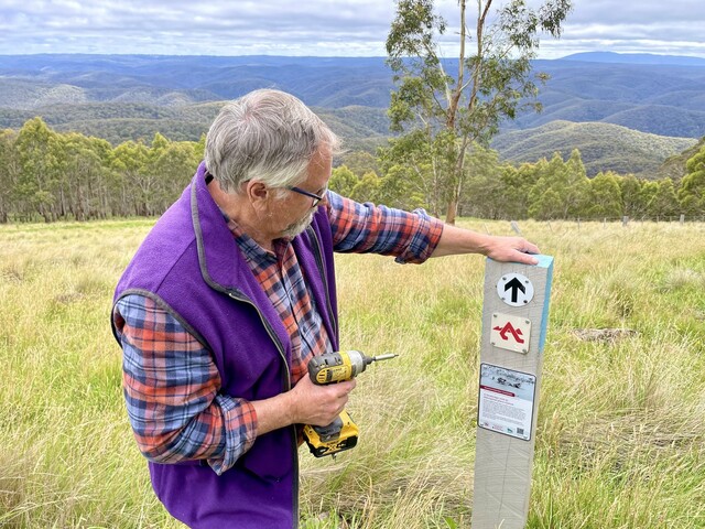
The Great Dividing Trail Association has launched an innovative, environmentally friendly interpretive signage project along the length of the 87 kilometre Lerderderg Track from Daylesford to Bacchus Marsh.
The volunteer hiking and biking group, has reduced the signage on the track to small placards on top of existing directional posts marking the way.
Each of the placards includes a QR code that links to more extensive information and images on the Great Dividing Trail Association website.
The signage tells the stories of the people who lived along the track and gives insights into the geology, the flora and fauna and the place names that track users encounter along the way.
GDTA publications manager Gib Wettenhall said this approach has minimised the environmental footprint of the interpretive signage.
More than 40 people gathered at the Garden of St Erth in Blackwood to celebrate the launch of the signage project.
Guests including GDTA patron Steve Moneghetti and Mountain bike ambassador, Lisa Jacobs, who praised the project for bringing the history of the track to life and making it easily accessible to track users.
Moorabool mayor Ally Munari remarked on the importance of the project.
“Projects like this make it more attractive for people to get out into our beautiful natural surrounds and keep active and healthy,” she said.
The interpretive signage project is the second stage of the GDTA’s work to refurbish the Lerderderg Track.
The track was built by the GDTA as the final stage in the 310 kilometre Great Dividing Trail Network, which includes the Goldfields Track from Ballarat to Bendigo.
In recent years, the Lerderderg Track had fallen into disrepair.
The GDTA obtained a substantial grant in 2018 to renew posts, signage and other infrastructure along the Track. This first stage of the refurbishment was completed in 2020.