Liam McNally
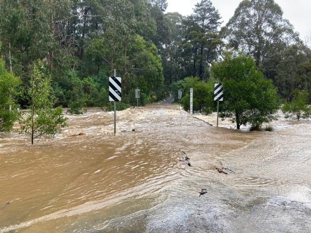
Roads are closed and a number of moderate flood warnings have been issue throughout Melton and Moorabool.
There is a major flood warning in place for the Werribee river below the Melton Reservoir.
The level of the Werribee River at Cottrell Street Ford is currently at 5.07 metres and rising.
The River is expected to peak around 5.4 metres.
Major flooding in the Werribee River catchment is expected to cause extensive inundation in the rural and urban areas, disruption to traffic, and may be isolation of some properties. Cottrell Street Ford is closed to traffic.
Moderate flood warnings are currently in place for The Lerderderg River, Werribee River above and Jacksons Creek.
Kororoit Creek has a minor flood warning in place.
According to Emergency Vic, most of these areas seem to have peaked and water levels are falling.
Emergency Vic website states that residents under a moderate flood warning should monitor weather forecasts and river levels and be prepared to move household items to higher ground, on top of tables, chairs, benches and beds.
At this level flooding above floor level of a single-story home is likely to occur in some locations. Heavy rainfall may lead to an increased risk of landslides, be aware of fallen earth, rocks, debris or trees.
A number of roads are closed in Moorabool council area due to flooding.
According to Victraffic, Ballan-Daylesford Road is closed between Carween Lane and Ruthven Street, Daylesford, and the Ballarat-bound exit from the Western Freeway to Old Melbourne Road, Ballan is closed. Use the ramps at Ballan-Daylesford Road instead.
Moorabool council Facebook page lists 15 shire roads that are closed as of 6.30am Friday, October 14:
Racecourse Road, Ballan between Old Melbourne Road to Connors Lane;
Spencer Road Ballan between Roch Court and Densley Street
Westcotts Road Wallace – between Hennesys Road and Old Melbourne Road
Road into Mill Park Ballan
Road to Caledonian Park, Ballan
North Blackwood Rd, 200 metres East of Golden Point Road
Bradys Lane Greendale
Eaglesons Road Lal Lal
Moorabool West Road, Gordon to Dehnerts Road Bunding
Dehnerts Road from Moorabool West Road to the Ballan Daylesford Road
Back Settlement Road, Korweinguboora at Dead Cat Creek.
Harris Road, Yendon
Muirs Lane, Korobeit
Butter Factory Road, Wallace, from Chapmans Road to Westcotts Road
Kellys Road, Grenville
There is also water over roads at a large number of sites, Moorabool council is urging people to reconsider their need to travel.
Sand and sandbags are available for Moorabool Shire residents at the BM Council Depot at 17 Kennedy Place in Maddingley and Ballan council office carpark at 15 Stead Street.
These are self-fill stations, so people are required to bring their own shovels.
Details: moorabool.vic.gov.au/floods, www.ses.vic.gov.au/-/sandbag-guide or www.emergency.vic.gov.au/respond


